Growing-degree-day (GDD) accumulation is the most widely used framework for tracking corn phenological development. Every corn hybrid carries a crop relative maturity (CRM) rating that corresponds to an approximate GDD requirement from emergence to black layer, typically ranging from 2,300 GDD for a 95-day hybrid to 2,750 GDD for a 115-day hybrid in the base-50 system. The problem with using county-level GDD averages to track individual field phenology is that spatial temperature variation within a county can be larger than many agronomists assume - and the error has specific consequences for both irrigation scheduling and yield forecasting.
How Large Are Within-County GDD Differences?
To quantify within-county GDD variation, we analyzed five years of weather station data from Iowa's IOWA Environmental Mesonet network alongside PRISM 4 km gridded temperature data. In Polk County (Des Moines area) - our home county and a representative central Iowa landscape - the range between the warmest and coolest 4 km grid cell from May 1 through August 31 averaged 68 GDD per year over the 2019-2023 period. In years with early-season temperature gradient events (cold late-spring nights in low-lying areas, warm southerly drainage in elevated positions), the range reached 94 GDD in a single county.
For a 108-day hybrid with a 2,540 GDD requirement, a 68-unit within-county spread means that a field on the warm side of the county could hit tasseling 2 to 3 days earlier than a field at the county average, while a field on the cool side could be 2 to 3 days later. The county average will be wrong for both fields. The practical implication depends on the specific question being asked. For rough crop insurance stage reporting, a two-to-three-day error is inconsequential. For timing irrigation to the pre-tassel window (where the yield sensitivity to moisture stress begins to increase sharply), the error translates directly into missing the optimal irrigation timing window.
The Tasseling Timing Problem in Detail
The two-week window around silking and pollen shed (approximately VT through R2) is the period of highest irrigation sensitivity in corn. As discussed in our article on management allowed depletion thresholds, yield sensitivity to water deficit triples compared to the vegetative stage during this window. CropKern's irrigation scheduling algorithm reduces the MAD trigger threshold automatically as the parcel approaches VT, based on GDD accumulation. If the GDD estimate is wrong by 50 units because we are using the county weather station average rather than the field-specific temperature record, the MAD reduction triggers 1.5 to 2 days off schedule.
Under typical conditions, a 1.5-day scheduling error is within the system's tolerance margin. Under high-VPD conditions when the soil profile is already at 40 percent depletion heading into the critical window, that 1.5-day lag can mean the pivot starts its pass 36 hours after the optimal trigger point. The profile could move from 40 percent to 55 percent depletion in a high-demand window while the system is waiting for a trigger that was slightly delayed by a GDD estimation error. This is not a catastrophic failure mode, but it is a consistent, systematic source of suboptimal scheduling that compounds across the season in warm fields that track systematically ahead of county averages.
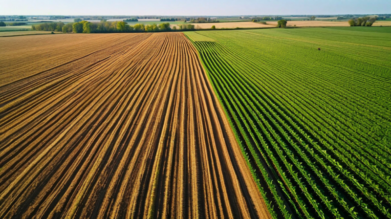
How Topography and Drainage Create Local GDD Variation
Corn plant temperature tracks air temperature closely, but air temperature varies spatially based on slope position, aspect, proximity to water bodies, and cold air drainage patterns. In Iowa's rolling glaciated terrain, south-facing slopes warm faster in spring and can accumulate 20 to 30 more GDD through May and June than north-facing slopes in the same county. Low-lying field positions near creek bottoms are subject to cold air pooling on calm, clear nights, accumulating 15 to 25 fewer GDD by late June than elevated field positions two miles away at the same county weather station. River-bottom fields often have late-season radiation fog that reduces solar radiation receipt and slows GDD accumulation during reproductive stages.
These effects are not exotic edge cases - they describe the normal landscape in any Iowa county with more than 20 feet of relief. An operation farming quarter sections across a landscape that spans 80 feet of elevation change is likely managing fields with GDD accumulation differences of 40 to 60 units by mid-July, all within the same county. Using a single county GDD value to stage all those fields introduces a systematic error that is predictable, directional, and correctable.
Field-Level GDD Tracking with On-Site Temperature Sensors
The most direct solution is deploying temperature sensors at canopy height in each field and computing GDD from field-level readings. CropKern's LoRaWAN sensor nodes include an air temperature sensor at a standard height of 1.5 m, which provides the maximum and minimum temperature readings needed for base-50 GDD calculation. Fields equipped with temperature sensors in CropKern show substantially lower phenological stage estimation error than fields relying on the nearest ASOS weather station. In a 2023 comparison across 64 instrumented parcels, field-sensor GDD tracking was within 12 GDD of actual tasseling date for 89 percent of parcels. County weather station GDD was within 12 GDD for 61 percent - a meaningful accuracy gap at the scale of scheduling decisions.
When PRISM Data Is Adequate and When It Is Not
PRISM gridded temperature data at 4 km resolution is CropKern's default GDD data source for fields without on-site temperature sensors. At 4 km, PRISM captures the broad topographic temperature gradient within a county but cannot resolve the within-2-km variation that drives the largest scheduling errors. For fields on undifferentiated flat terrain where the 4 km cell average is representative of the field's actual thermal environment, PRISM is adequate. For fields in complex terrain with significant local variation - river bottoms, elevated field edges, south-facing hillslopes - PRISM will introduce systematic errors of 20 to 40 GDD by mid-season.
The practical test is to compare the first three weeks of canopy development (emergence through V3) against the expected GDD timeline for your hybrid. If field emergence date and early growth stages are tracking ahead of or behind the PRISM-based GDD accumulation by three or more days consistently, the PRISM data is not representative of your field's thermal environment and on-site temperature sensing should be prioritized. Contact [email protected] for information on sensor deployment options that include temperature monitoring for field-level GDD tracking.
Implications for Yield Map Interpretation
Field-level GDD variation also affects how yield maps from past seasons should be interpreted. A warm, south-facing field edge that consistently accumulates 50 additional GDD by mid-season is effectively running a slightly shorter-season hybrid equivalent than the labeled CRM suggests. If that field position shows consistently lower yield than the cool north-facing portion of the same field in normal or above-normal temperature years, the apparent yield gap may be partly attributable to the warmer position exceeding the hybrid's optimal thermal accumulation for grain fill duration. Yield maps that appear to show a soil productivity gradient may actually contain a thermal gradient component that is invisible until field-level temperature data is overlaid on the yield map. CropKern's parcel analytics module supports this overlay for operations with multi-year yield map history and temperature sensor data from the same periods.