Leaf area index (LAI) - the total one-sided leaf area per unit ground area - is one of the most useful state variables for characterizing crop canopy development and linking it to both photosynthetic capacity and yield potential. Satellite-derived LAI retrieval from multispectral sensors has been an active research area for three decades, and operational LAI products are now available from both Sentinel-2 and MODIS at various spatial and temporal resolutions. This article discusses what Sentinel-2-derived LAI can and cannot reliably provide for operational crop management at the field scale, and how CropKern uses LAI estimates in the yield forecasting pipeline.
How Sentinel-2 LAI Is Retrieved
Sentinel-2 LAI products used in operational precision agriculture are typically derived through one of three approaches: empirical relationships between LAI and vegetation indices (most commonly NDVI or red-edge-based indices), radiative transfer model inversion (fitting a canopy reflectance model such as PROSAIL to the observed reflectance spectrum), or hybrid methods that use neural networks trained on simulated PROSAIL spectra. The ESA Biophysical Processor in SNAP uses a neural network approach trained on PROSAIL simulations and is widely used in research applications. CropKern uses a hybrid empirical-physical approach that combines a red-edge vegetation index (NDRE and the two-band enhanced vegetation index) with phenological stage constraints to bound the LAI estimate within agronomically plausible ranges for the current growth stage.
The uncertainty of satellite-derived LAI at field scale is not constant across the season. Early season (emergence through V5), when canopy cover is below 30 percent, soil background dominates the spectral signal and LAI uncertainty is high - typically +/- 0.5 m2/m2. At peak canopy (V10 through R3), when the signal-to-noise ratio is highest for vegetation indices, LAI uncertainty decreases to approximately +/- 0.8 m2/m2 against in-situ destructive measurements. At high LAI values above 4.5, the retrieval saturates (the same problem as NDVI saturation, discussed in our article on NDVI in irrigated corn) and precision degrades again. The practical implication is that satellite LAI is most reliable in the V6-to-V10 window - exactly the stage where it feeds into early-season yield trend analysis.
LAI as a Predictor of Mid-Season Yield Potential
The agronomic relationship between LAI and yield potential runs through radiation use efficiency (RUE) - the conversion of intercepted photosynthetically active radiation (PAR) into above-ground dry matter. At LAI values above 3.0, crop canopies intercept more than 90 percent of incident PAR, meaning further increases in LAI add little to light interception or potential photosynthesis. However, the trajectory of LAI development through the vegetative period contains information about stand establishment, early-season nutrition, and soil moisture availability that predicts yield potential before the signal appears in standard NDVI or NDRE metrics.
In CropKern's forecast model, the rate of LAI increase from V3 to V7 (the linear portion of the canopy development curve) is an independent predictor of yield potential for the current season, entered alongside the accumulated spectral index values. Fields that are 15 to 20 percent behind the expected LAI development trajectory by V7 - indicating slow early canopy development - show a yield penalty that is not always visible in NDVI metrics because NDVI responds primarily to chlorophyll concentration, not to canopy coverage fraction. A field with normal chlorophyll concentration but below-expected plant density (due to cold soil at emergence, seedbed pest pressure, or planting depth issues) will have normal NDVI but below-expected LAI, and the LAI signal captures the yield shortfall earlier in the season.
LAI for Crop Coefficient Adjustment
As discussed in our article on Penman-Monteith ET calculation, actual crop ET requires multiplying reference ET by a crop coefficient (Kc) that varies with canopy development. The standard FAO-56 Kc curve assumes ideal canopy establishment on a standard development timeline. When canopy establishment deviates from the standard curve - because of stand gaps, delayed emergence, or early-season stress - using the standard GDD-based Kc overestimates actual ETc from affected parcels. CropKern uses satellite-derived LAI to adjust the Kc calculation for parcels with below-expected canopy cover fraction. If LAI at V6 is 30 percent below the expected value, the Kc is reduced proportionally from its standard V6 value, which prevents the water balance model from crediting more ET demand than the canopy is actually capable of producing.
This adjustment is particularly relevant for parcels with late replanting or partial stand loss after hail or flooding events. Operations that do not report replant or stand loss events to CropKern will see the satellite-derived LAI automatically catch the stand deviation and adjust Kc accordingly within two to three satellite passes - typically within 10 to 15 days of the stand loss event. The automatic Kc adjustment prevents over-irrigation of a weakened or partially replanted stand, which would be both wasteful and counterproductive in a stand trying to recover from root zone saturation or physical damage.
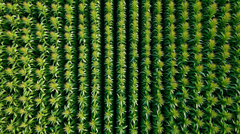
Limitations: Sun Angle and Row Orientation Effects
Row-crop fields introduce a geometric complexity for remote sensing that is not present in continuous canopies: the inter-row gap fraction depends on the satellite observation angle relative to the crop row orientation. At high sun angles (solar noon in summer, approximately 72 degrees altitude in Iowa), Sentinel-2 images the canopy near-nadir and inter-row gaps are minimized. At lower sun angles (early morning or late afternoon acquisitions, or early/late season when solar altitude is lower), shadows from the crop rows extend across the inter-row space and artificially inflate the apparent green fraction. This effect can cause apparent LAI to vary by 0.4 to 0.8 m2/m2 between acquisitions at different solar angles, independent of any actual canopy change.
CropKern's LAI pipeline applies a row direction correction that estimates the fractional row shadow contribution based on the sun-sensor geometry of each acquisition and the dominant row orientation for each parcel. Row orientation can be entered manually in parcel metadata or estimated from the parcel boundary shape for fields with predominantly north-south or east-west row directions. For fields with unusual row orientations (diagonal rows, curved rows following field boundaries), the automatic correction may be less accurate and manual row orientation entry is recommended. Contact the team at [email protected] if you notice large acquisition-to-acquisition LAI jumps in spring imagery that appear unrelated to canopy development events.