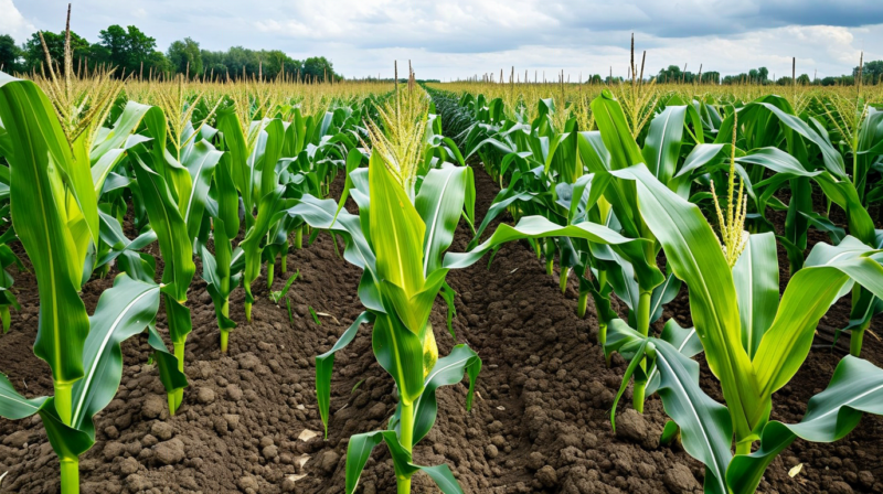
In mid-July 2023, CropKern flagged a NDVI anomaly on a 160-acre soybean parcel in western Iowa. The alert described an oval-shaped low-NDVI zone covering approximately 35 acres in the north portion of the field, with a satellite-derived depletion pattern consistent with a drainage event or waterlogging episode. The parcel's SDI-12 sensor at 30 cm depth showed volumetric water content near field capacity - plausible for waterlogging. The agronomist managing the account drove to the field expecting to find saturated soil and yellowing from oxygen deprivation. What he found instead was interveinal chlorosis - yellowing between the leaf veins while the veins remained green - in a pattern characteristic of iron deficiency chlorosis (IDC). The soil was not wet. The anomaly was not waterlogging. It was a high-pH calcareous inclusion in the north end of the field, where soil pH near 7.8 renders iron unavailable to soybean roots. Satellite cannot distinguish these two conditions at 10 m resolution. The spectral signature looks nearly identical. This article explains why, and what a functional ground validation workflow looks like.
The Spectral Confusion Between Waterlogging and IDC
Both waterlogging and iron deficiency chlorosis reduce chlorophyll content in the leaf tissue, producing a reduction in red-band absorption and a characteristic NDVI decline. The spatial pattern of both stresses can appear as oval or irregular zones that follow landscape features. Waterlogging zones follow microtopographic depressions and drainage patterns. IDC zones follow soil pH or calcium carbonate (CaCO3) content gradients. Without a soil EC map or soil pH history, these gradients are not visible in the satellite image. At 10 m Sentinel-2 resolution, the 5-to-8-pixel anomaly zone produced by either stress is spectrally indistinguishable. Even at 3 m PlanetScope resolution, the chlorophyll reduction signal is the same - resolution does not provide a spectral chemistry measurement.
The NDRE signal adds some information here: waterlogging stress tends to cause a broader chlorophyll degradation that reduces NDRE more uniformly across the canopy layer, while IDC in soybean creates a specific interveinal pattern that reduces leaf area index contribution from affected leaves slightly less than it reduces chlorophyll concentration per unit area. In practice, the NDRE response to both stresses falls within overlapping ranges at the current precision of commercial satellite sensors. An alert generated from a satellite anomaly - whether flagged as waterlogging, nitrogen deficiency, or other - should be treated as a location-specific indication that the field warrants visual inspection, not as a diagnosis.
Other Spectrally Confusable Stress Conditions
The IDC-versus-waterlogging confusion is one of several spectrally similar stress pairs that occur in Corn Belt agriculture. Nitrogen deficiency in corn produces a characteristic firing pattern from the leaf tip, causing uniform yellowing that reduces NDVI in a way that is similar to early-stage drought stress. The distinction between N deficiency and drought stress requires knowing the soil moisture status (available from SDI-12 sensors) and the application history (from the agronomist's records). CropKern's alert system cross-references soil moisture readings when generating stress alerts, reducing the rate of N-deficiency-versus-drought confusion when sensor coverage is adequate.
Pest pressure - specifically rootworm damage in corn - creates a canopy response that begins in mid-July and produces a lodging and root damage pattern that reduces NDVI in affected areas. Rootworm damage zones often follow crop rotation history (corn-on-corn fields are higher risk) and soil type (sandy soils with lower rootworm predation). The satellite detects the canopy consequence - partial lodging and uneven stand - but cannot identify the cause. Gray leaf spot, northern corn leaf blight, and tar spot all produce NDVI reductions in affected areas during the vegetative-to-reproductive transition, but the satellite cannot distinguish fungal disease from abiotic stress based on spectral signal alone.
Building a Ground Validation Workflow
An effective ground validation workflow for satellite-flagged anomalies has three components: a prioritization system, a rapid field protocol, and a feedback loop to improve future alert calibration. Prioritization should use anomaly size, anomaly severity, and growth stage. A 5-acre anomaly at R1 during the highest yield-sensitivity window warrants same-day or next-day scouting. A 2-acre anomaly at V5 during the vegetative stage can typically wait for the weekly field walk. CropKern's alert dashboard includes a priority score that combines these factors and allows agronomists to review the most consequential anomalies first.
The rapid field protocol should include a brief visual inspection of affected plants, a soil probe reading at 15 cm and 30 cm depth to confirm or rule out waterlogging, a visual check for pest evidence (frass, leaf lesions, root exposure), and a GPS-tagged note in the CropKern mobile app with the agronomist's diagnosis. This takes approximately 20 to 30 minutes for a standard parcel anomaly visit. The GPS-tagged note with a confirmed diagnosis (IDC, N deficiency, waterlogging, rootworm, disease, or other) becomes a training data point for alert calibration.
How Confirmed Ground Data Improves Alert Precision
Every confirmed scouting note in CropKern is associated with the satellite index values at that location on the date of the anomaly flag. Over time, confirmed diagnoses build a labeled dataset of spectral signatures at specific locations, soil types, and growth stages. For operations with three or more seasons of consistent scouting note entry, the alert system can reduce false positive rates for the specific stress types that have been systematically misclassified on those fields. This is not a universal benefit from day one - it requires consistent data entry during scouting visits. Operations that use the mobile app to enter every anomaly visit and confirm every diagnosis typically see a 20 to 30 percent reduction in low-priority alerts by their third season, because the system learns to downweight the false positive signatures specific to their field configuration.
The IDC Field: What Was Done and What It Cost
Returning to the 2023 IDC case: the agronomist's ground visit identified a calcareous soil inclusion visible on a historical EC map that had not been loaded into the parcel's background data. The IDC zone was annotated in CropKern, and the affected area was flagged for iron chelate or sulfur amendment consideration in 2024 to lower the effective pH. In 2024, the same field was treated with an IDC-tolerant soybean variety in that zone, and the anomaly did not recur. The yield map from the 2023 harvest showed a 7.2 bu/ac yield gap in the IDC zone compared to the surrounding field - recoverable in 2024, but a real cost for the season the diagnosis was made after planting.
The lesson is that satellite anomaly alerts are most valuable as early-warning dispatchers, not as diagnostic systems. They direct attention to the right location at the right time in the season. The diagnosis still requires someone on the ground with a probe and a pair of eyes. For precision agriculture tools to pay their way, the data they generate needs to consistently result in field action - not just a notification that is acknowledged and not acted on. Building a reliable ground validation habit is as important as the monitoring technology itself. If you have questions about setting up alert thresholds or the scouting note workflow in CropKern, reach out to our agronomy team at [email protected].